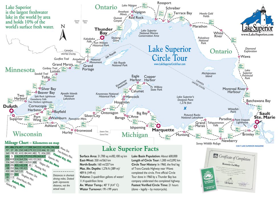
Circle Tour Map
This map represents the Lake Superior Circle Tour, the relative positions of the city and towns around the lake, major parks and islands and the distances between locations. It does not represent the highways between towns.
Download a larger version of this map.
Our Full-Size Travel Map
Our more complete Lake Superior Travel Map is available free of charge at most information stops around the lake, as a part of the Lake Superior Travel Guide annual and through the mail. Jump to our free Travel Map offer if you desire the highway map. It will take up to two weeks to get it to you. If you are planning a trip sooner than that, wait until you're in the region, then pick up the map free at any information center. Be sure to check out the Lake Superior Circle Tour Club for comments from folks who have completed travel around the Lake Superior Circle Tour.
